

Instruments
An artificial horizon with speed, altitude and heading tapes, plus battery, link quality and the way home. Show only the parts you want.
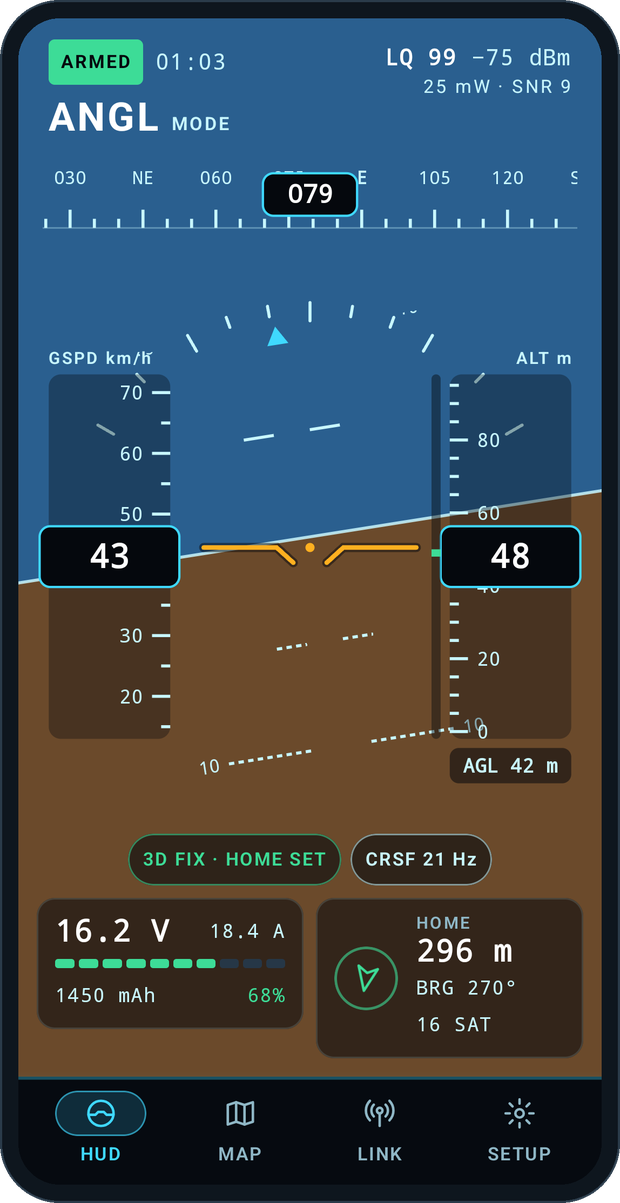
In the air force, the wizzo is the weapons systems officer: the one in the back seat watching the instruments while the pilot flies. Wizzo does that job for drone pilots. Plug your EdgeTX radio into your phone, or pair it over Bluetooth or Wi-Fi, and Wizzo keeps an eye on the numbers.
Instruments
An artificial horizon with speed, altitude and heading tapes, plus battery, link quality and the way home. Show only the parts you want.
Moving map
Road or terrain maps with the drone, its trail, home and you. Your area is cached, so it keeps working when the field has no signal.
Height above ground
iNav only knows height above home. Wizzo uses terrain data to show height above the ground, and warns before rising ground gets too close.
Follow-me
With the Wizzo Lua bridge on the radio, an iNav multirotor follows you. A switch on the radio engages it, and flipping it back always takes control.
Any link
USB-C straight into the radio, Bluetooth LE, or Wi-Fi. Works with ExpressLRS and any CRSF link.
Easy setup
The Bridge wizard copies the Lua script onto the radio for you and checks it’s running.